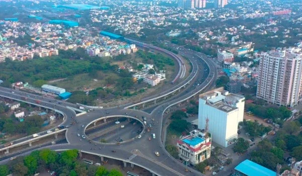
Prestige Clover Dale Map


Featured Image of Prestige Clover Dale Map

The Prestige Clover Dale Map shows the exact location of the 16-acre township in Padi, North Chennai. It marks nearby roads, metro stations, IT hubs, schools, as well as hospitals. The map helps buyers understand how well the project connects to Anna Nagar, Mogappair, and Ambattur. It makes it easy to check travel routes and access the site on Google Maps. This map gives a clear visual view of the venture and its nearby facilities.

You can view the exact location pin on Google Maps. The project coordinates are:

  • Latitude: 13.0882° N (Approximate)
  • Longitude: 80.1844° E (Approximate)

The map shows that this grand venture is located in the top locality of Padi, North Chennai. It is in close proximity to major commercial and corporate zones. Buyers can easily find the venture using the map view. The map helps users check approach roads, nearest highways, nearby townships, schools, and hospitals around the property.

Prestige Clover Dale is a top-end housing apartment township brought by the Prestige Group. It is spread across 16 acres of land. It is home to 18 to 20 large, high-rise towers. These towers comprise over 2,200 premium flats in 1, 2, 2.5, 3, and 4 BHK layouts. The property is currently in its new launch stage. The map highlights the main entry points right on Madras Thiruvallur High Road (CTH Road). It shows how the project sits perfectly within the North Chennai growth corridor.


Commuting Stations and Road Connectivity


The map shows excellent transport options for future residents.

  • Roads: The project has strong road connectivity through major routes. It grants direct access to CTH Road. It connects well to the 100 Ft Road as well as the Inner Ring Road. It also links easily to the Ambattur Estate Road. The CTH Road belt is highly preferred because it connects major residential zones.
  • Metro Connectivity: It has strong metro connectivity through the Green Line. This makes daily travel simple for residents. The nearest station is Thirumangalam Metro Station, located just 3 km away. It is an easy 5 to 7-minute drive from the property. Anna Nagar Tower Metro Station is also close at 3.8 km away.
  • Rail: Prestige Clover Dale offers quick access to local railway stations. The nearest one is Korattur Railway Station, which is just 3 km away. Villivakkam Railway Station is also nearby. These stations connect to the suburban rail routes, making office travel highly convenient.
  • Air: The closest airport is Chennai International Airport. It is located roughly 19.6 km away from the project site. Residents can reach the airport smoothly via the Inner Ring Road connection.

Nearby Employment Hubs and Infrastructure


The location map highlights direct road links to key corporate as well as industrial corridors such as the

  • Ambattur Industrial Estate: 4.5 km
  • Ambit IT Park: 4.2 km (Approximate)
  • Kosmo One Tech Park: 4.0 km (Approximate)
  • HCL Corporate Offices: Located in close proximity

Basic Facilities Marked on the Map


  • DRJ Hospital: 1.5 km
  • VR Chennai Mall: 1.9 km
  • Spartan Matriculation School: 2.5 km

These facilities are clearly marked on the location map. Buyers can see how close daily needs, education, shopping, and healthcare are to the site.

The official location map is available in the venture's brochure. Once you visit the site, the exact Google Maps pin will be shared for easy smartphone navigation.

Upcoming Developments Near Prestige Clover Dale


  • New widening projects along the CTH Road corridor.
  • Proposed phase-wise Chennai Metro rail extensions.
  • Rapid growth of new commercial zones around Padi junction.
  • Multiple premium high-rise projects driving local infrastructure upgrades.

Frequently Asked Questions


1. Where exactly is Prestige Clover Dale located on the map?

The enclave is located directly on the Madras Thiruvallur High Road (CTH Road) in Padi, North Chennai. It is exact opposite to the famous Saravana Stores landmark.

2. What is the nearest metro station shown on the map?

The nearest station is Thirumangalam Metro Station on the Green Line. It is just 3 km away from the property gates. You can reach it in 5 to 7 minutes.

3. How does the map show connectivity to major IT hubs?

The map highlights direct links to the Ambattur Industrial Estate as well as Ambit IT Park. Residents can use the Ambattur Estate Road for a quick daily office commute.

4. Are there local railway stations near the project?

The map marks two nearby stations. Korattur Railway Station is 3 km away, as well as Villivakkam Railway Station is also close by. Both feed into the city's suburban rail network.

5. How far is the Chennai International Airport from the township?

The Chennai International Airport is located roughly 19.6 km away. The map shows a direct, simple route via the Inner Ring Road to cut down on travel time.

Enquiry
Enquire Now